Settings Menu
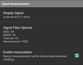
Signal Measurements
This menu provides settings to change the displayed signal type and allows the user to define a signal filter. When using a signal filter, only the signals that match will be displayed on the map view on Android, but all signals will be captured in the signal map for review in NEON Command. When interpolation is enabled, smaller dots will fill in the gaps between actual data points.
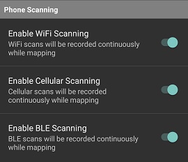
Phone Scanning
This menu is used to disable scanning of certain signals. By default, Wi-Fi, Cellular and BLE scanning is enabled. The benefit of disabling scanning is that it increases the battery life of the phone. However, disabled signals will have no data for that signal in the signal map to review in NEON Command.
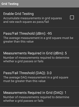
Grid Testing
This menu is used to enable grid testing and allows configuration of the pass/fail criteria and the number of measurements required per grid. The output of enabling grid testing is that the floor plan will automatically be overlaid with grids sized per the NFPA in building testing recommendation. The grids are colored green if they pass, red if they fail, gray if there are not enough signal readings, and transparent if the grid has never been visited.
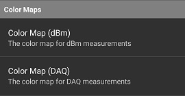
Color Maps
This menu is used to select a pre-defined color map. The color map is used to determine the color that is associated with a signal strength. The color map determines which colors are displayed in the color dots and heat map. Custom color maps may be created in NEON Command.
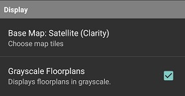
Display
This menu is for selecting a different base map layer and gray scaling the floor plans. The default is satellite (Clarity). If a building is newly built and does not appear on the base map, the satellite (Latest) layer may have it. When operating in urban areas, the open street maps layer may be the best choice since it displays a clear building footprint, and the buildings are often displayed at an angle in satellite imagery. The benefit of gray scaling the floor plans is that it declutters a colorful floor plan so that the heat map and color dots are more visible.
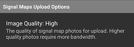
Signal Maps Upload Options
This option determines the compression applied to the image before it is sent up to the NEON Cloud. High quality has no compression applied, it is simply whatever the camera captures. Medium is 50% compression, and low is 75% compression.