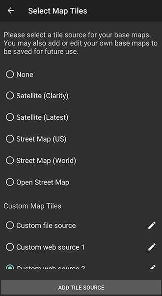
Map Tile Selector
By default, NEON Apps includes several ESRI Base Map sources for imagery. The Map Tiles menu allows you to add other imagery sources for use in all NEON Apps.
Creating a Custom Base Map Source
To create a new base map source, click the “Add Tile Source” button on the bottom. This will bring up the Tile Source Edit Dialog.
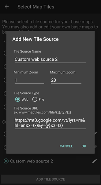
Here, the display name of the Tile Source must be set, as well as the information on where the base map tiles come from.
There are two types of Tile Sources:
- Web - A Webserver hosting a TMS Tile Server
- File - A directory on your phone containing tiled image files
For Web and File Sources, a “placeholder” URL is generally required. The special tokens “{x}” “{y}” and “{z}” will be replaced when querying the URL with the TMS tile coordinates of the area desired.
For examples, here are the tile URLs used in the default tile sources built into the NEON Command software:
- https://clarity.maptiles.arcgis.com/ArcGIS/rest/services/World_Imagery/MapServer/tile/{z}/{y}/{x}
- https://server.arcgisonline.com/ArcGIS/rest/services/World_Imagery/MapServer/tile/{z}/{y}/{x}
- https://server.arcgisonline.com/ArcGIS/rest/services/World_Street_Map/MapServer/tile/{z}/{y}/{x}
- https://stamen-tiles.a.ssl.fastly.net/terrain/{z}/{x}/{y}.jpg
Editing a Custom Base Map Source
You can edit or delete an existing custom tile source by clicking on the pencil icon on the right of the tile source.
NOTE: You can only edit and delete Custom Tile sources.