New Buildings
New buildings or buildings under construction may not be visible on some basemaps. You might find yourself in a situation where a new building is not visible on any Esri maps. This makes it nearly impossible to sketch out the building outline. There are 3 potential solutions to this.
-
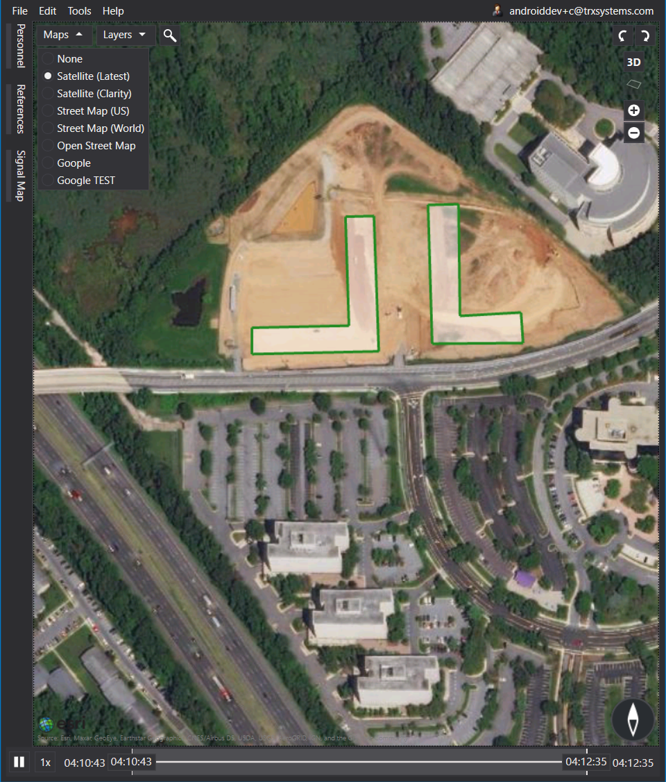
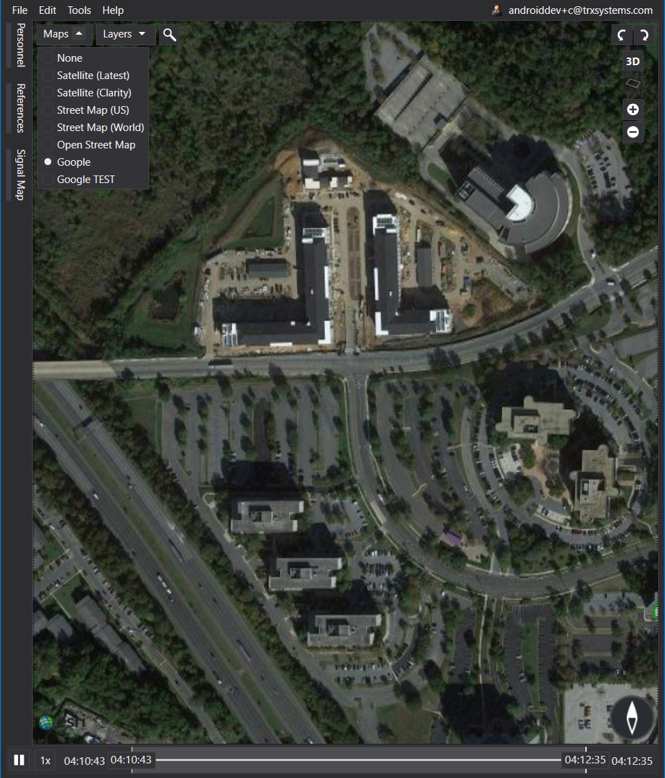
In NEON Command, select a map other than satellite. These maps are loaded from different sources, so one may be more up to date than another. The default map in NEON Command is Satellite (Clarity), but there is an option for Satellite (Latest). This shows the most recent satellite tiles available, even if they distort perspective a bit.
-
In NEON Command, zoom out just a little bit until a new satellite image loads in where your building should be. Because map providers update satellite images of different zoom levels at different rates, it is possible that your new building has been captured already at a different zoom.
-
Use Google maps to find the coordinates of the building corners. You can use Google maps and waypoints to create land marks to help sketch the building outline.
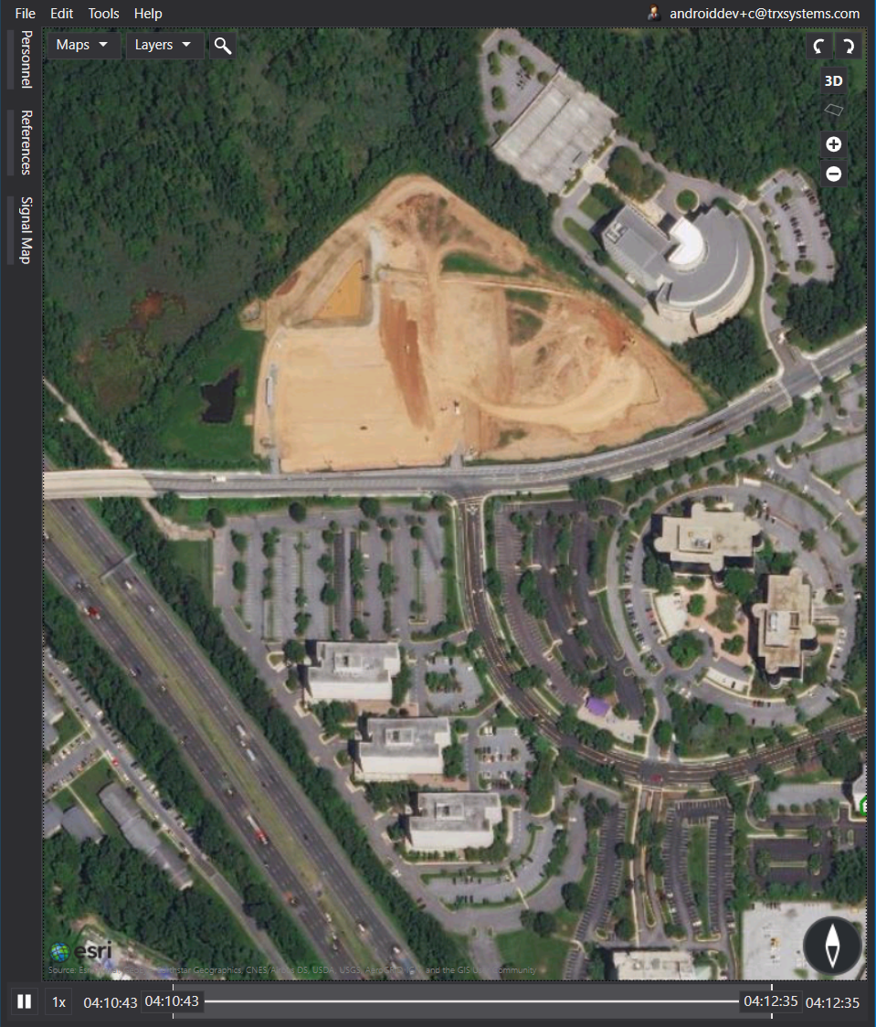
In this example, you will see how to map a new building located on Cherrywood Lane in Greenbelt, MD, USA, which is under construction. As you can see in the first image below, the building is not visible in the Esri maps satellite imagery, but is visible in the second image - the Google basemap.
To create this building without the basemap, you will need NEON Command loaded on your PC and access to www.google.com/maps.
How to Create a New Building without Basemap Imagery:
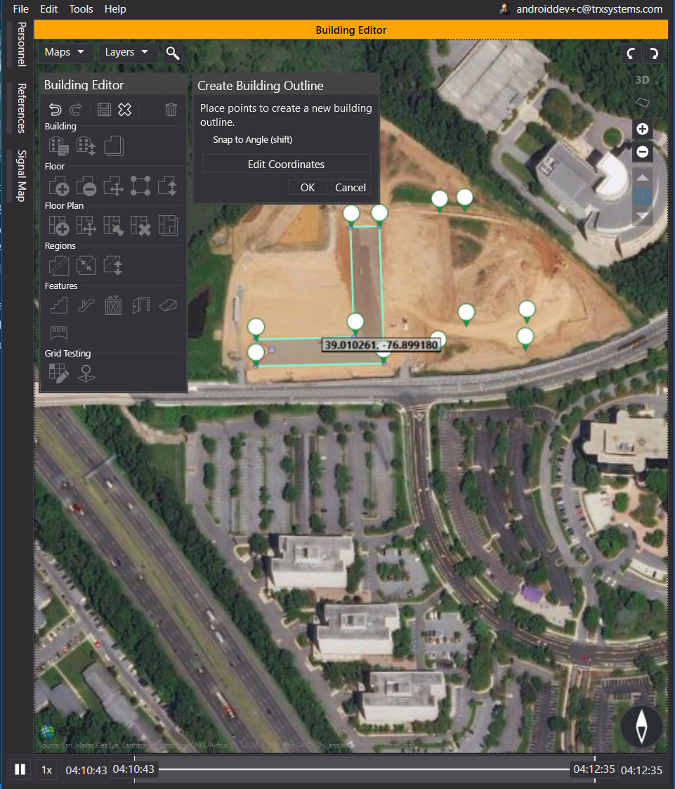
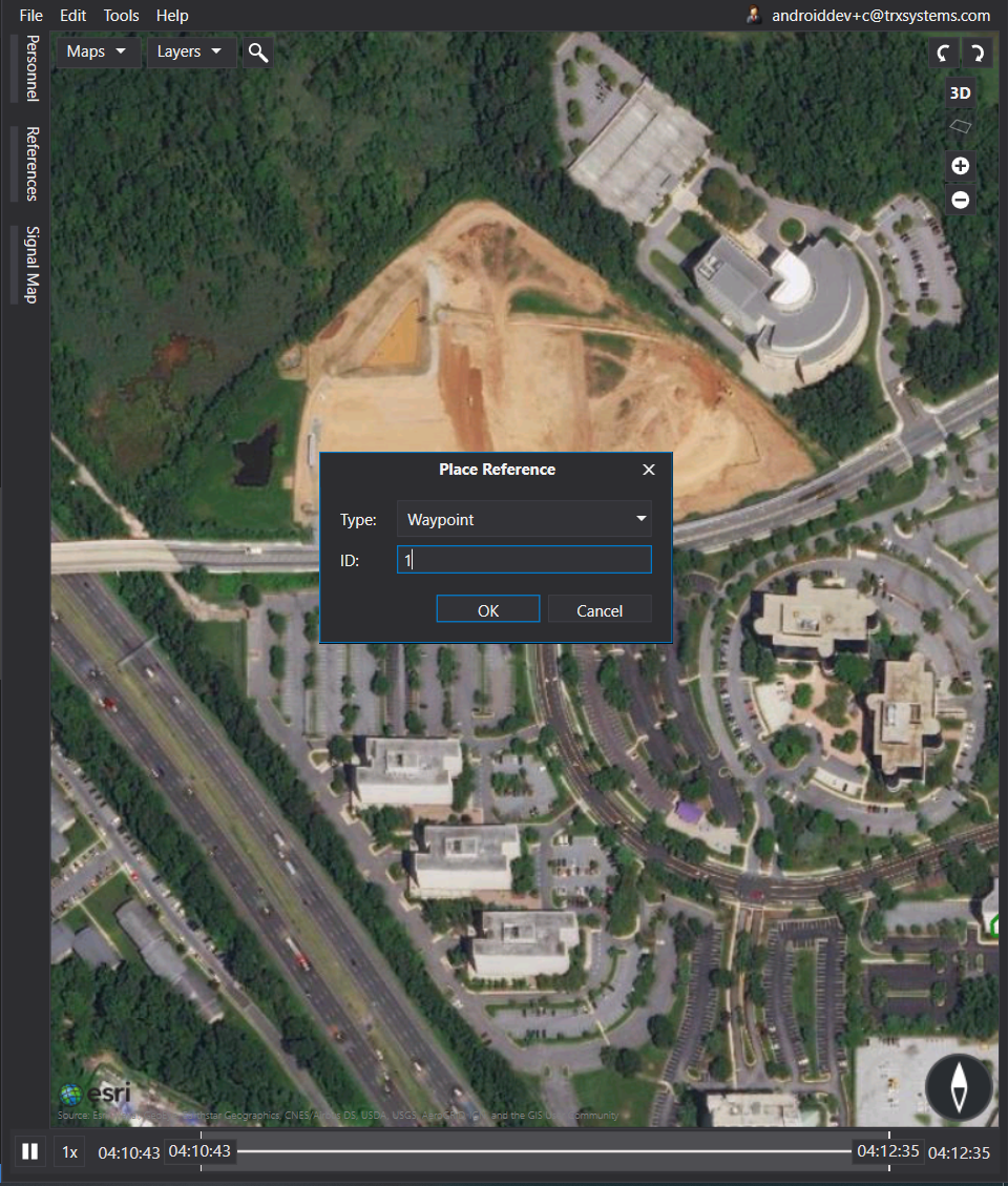
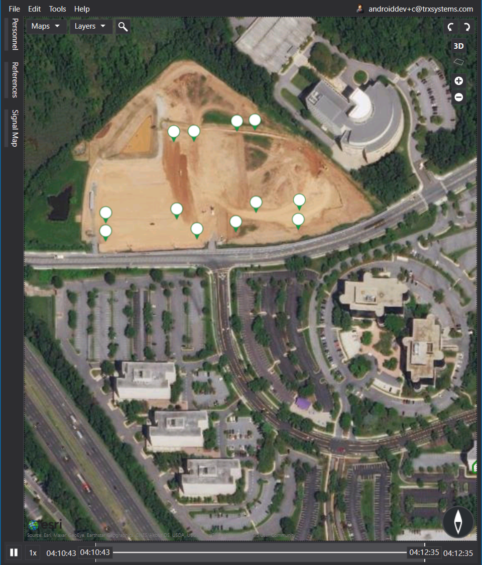
- In NEON Command, begin by right clicking on the map, in the general location of a corner of your building. Select “Place Reference”. Set the type to “Waypoint” and set the ID as “1”. Right now, it does not matter how accurate this waypoint is. We will correct it later.
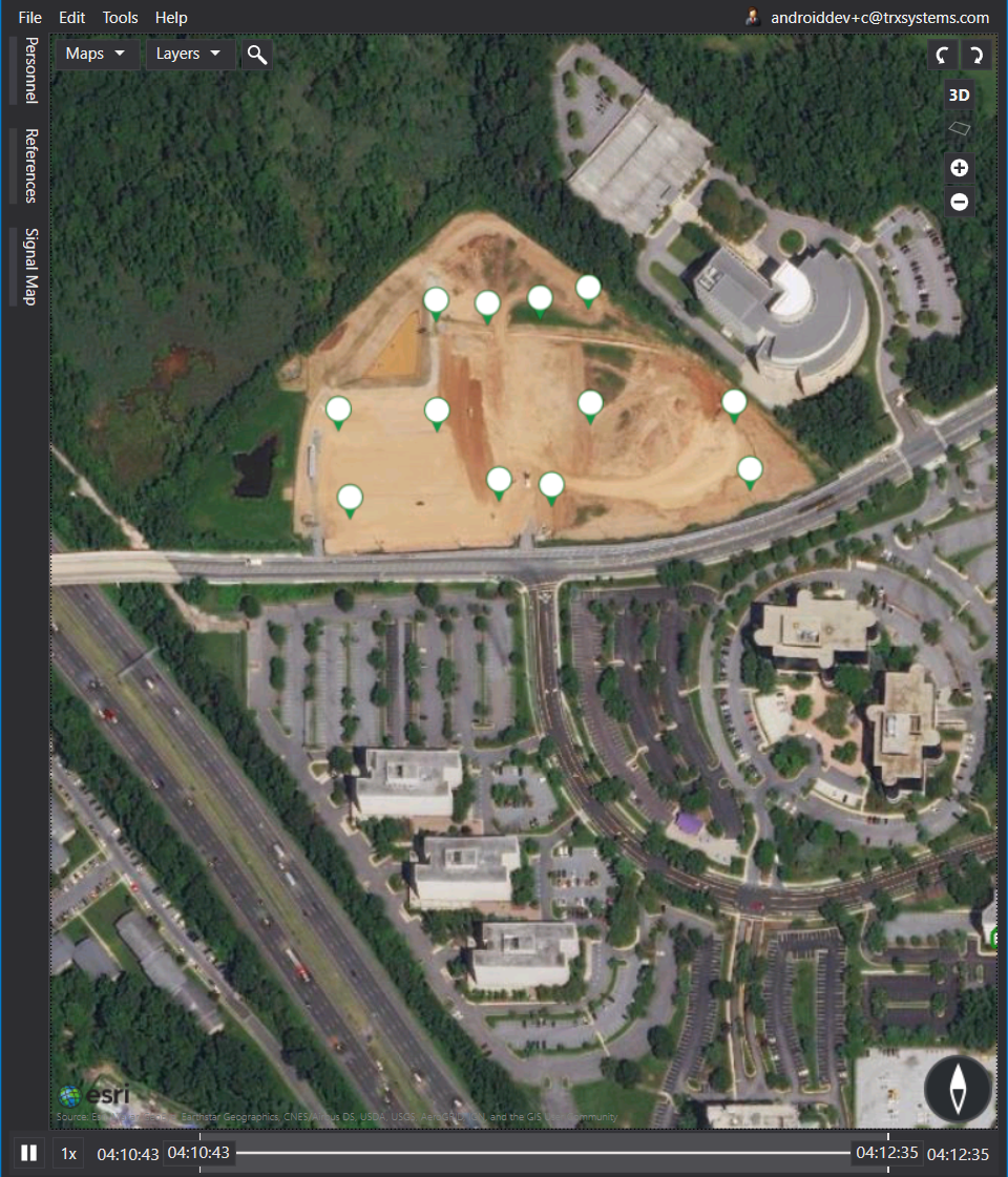
- Repeat step 1 for each corner of your building, each time updating the ID (i.e. 1, 2, 3, etc.). After this you should have a rough shape of your building.
-
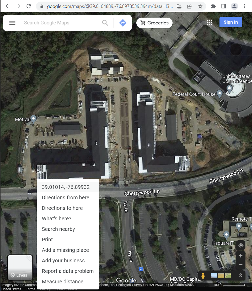
In Google Maps, turn on the satellite layer and find your building.
-
Click on one of the corners of the building outline. This will create a pin icon and you will see a text box at the bottom with coordinates for the pin.
-
Click on the coordinates in the text box. This will open the left sidebar and the coordinates are now easy to copy/paste.
-
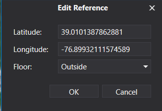
Back in NEON Command, right click on the waypoint, and select “Edit Location”. Copy and paste the latitude and longitude from Google. Click OK when complete.
- Repeat steps 4, 5, and 6 for each waypoint added earlier. When complete, your waypoints should resemble your building very closely.
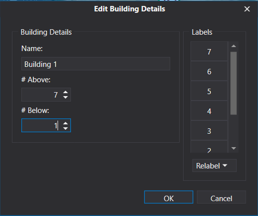
- Right-click on the map and select “Create Building”. Place your building vertices at the waypoints. Once the outline is complete, press Enter to commit it. You will be prompted to edit your building details, where you can add floors, label the floors, and name the building. Click OK to commit any changes, then click on the Save icon to save your new building to the cloud. When the building is complete, delete the waypoints by right-clicking on the icons and selecting “Delete.”